Last reviewed and updated: March 2026
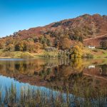
The Mam Tor Circular Walk is one of the most popular hikes in the Peak District. Known as the “Shivering Mountain”, Mam Tor sits above the Hope Valley and offers some of the most beautiful views in the national park.
This circular route climbs to the summit of Mam Tor before following the famous Great Ridge towards Back Tor and Lose Hill. It’s a fantastic walk for beginners and experienced hikers alike, combining easy paths, dramatic ridge views and classic Peak District scenery.
Because the route is relatively short and easy to follow, it’s one of the best walks in the Peak District for anyone looking to experience a classic ridge hike without committing to a full-day mountain walk.
Mam Tor Walk Overview
Distance: 6 km (3.7 miles)
Difficulty: Moderate
Time: 2–3 hours
Start point: Mam Nick Car Park
Mam Tor Circular Route Description
The Mam Tor Circular Walk usually begins from Mam Nick Car Park, located on the road between Castleton and Edale. This car park sits at a high point in the valley, meaning you’re already partway up the hill before starting the climb.
From the car park, follow the well-maintained stone path that heads uphill towards the summit of Mam Tor. The path is easy to identify and consists mostly of large stone steps that make the climb straightforward.
The ascent begins gradually before becoming slightly steeper as you approach the summit ridge. Along the way you’ll begin to see the beautiful landscape of the Hope Valley opening up behind you.
On clear days the views across the valley are fantastic, with the village of Castleton visible in the distance and rolling Peak District hills stretching across the horizon.
After around 20–30 minutes of climbing, you’ll reach the summit of Mam Tor.
Standing at 517 metres, Mam Tor isn’t one of the highest hills in the Peak District, but the exposed ridge means the views from the summit feel much bigger than the height suggests. The summit is marked by a small trig point and is a popular spot for walkers to stop and enjoy the scenery.
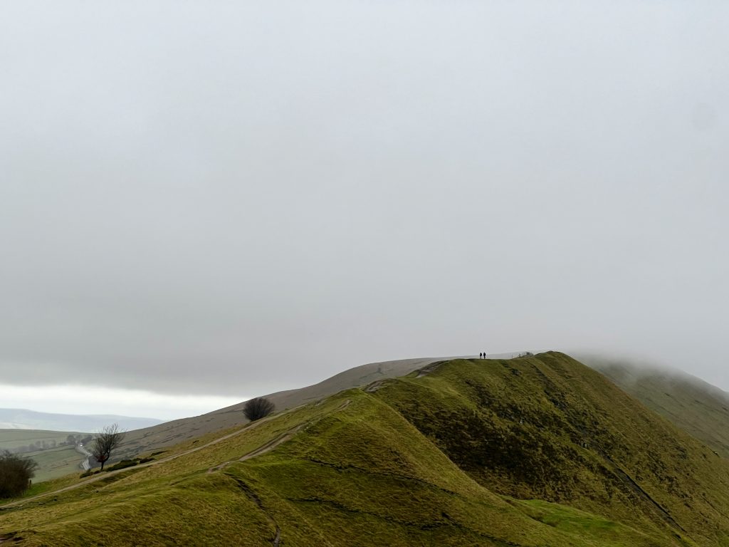
From the summit, the walk continues along the Great Ridge, one of the most famous ridge walks in the Peak District.
The path here is wide and well maintained, following the narrow ridge between the valleys below. This section of the walk offers incredible panoramic views on both sides of the ridge.
Continue along the path as it gently descends towards Back Tor, a rocky outcrop along the ridge. This part of the walk is particularly scenic and gives you a real sense of walking high above the surrounding landscape.
After passing Back Tor, the path climbs again towards Lose Hill, also known as Ward’s Piece. This steady climb leads to another fantastic viewpoint overlooking the Hope Valley and the village of Hope below.
Once you reach the summit of Lose Hill, take some time to enjoy the views before beginning the descent.
From Lose Hill, follow the clear path downhill towards the valley. The route descends steadily towards the fields near the village of Hope.
Before reaching the village itself, take the path that curves back towards Mam Nick, looping around the base of Mam Tor to complete the circular route.
This final section is more relaxed and provides a different perspective of Mam Tor from below. The path eventually reconnects with the road near Mam Nick Car Park where the walk began.
Tips for the Mam Tor Walk
Mam Tor is one of the most accessible hikes in the Peak District, but there are still a few things worth keeping in mind before heading out.
• Parking can fill up quickly. Mam Nick Car Park is small and often full during weekends or good weather. Arriving earlier in the day usually makes things easier.
• Expect the trail to be busy. Mam Tor is one of the most visited walks in the Peak District, especially during summer and on sunny days.
• Check the weather forecast before setting out. The Great Ridge is quite exposed and strong winds are common even when the valley feels calm.
• Wear proper walking footwear. The stone steps leading to the summit can become slippery after rain.
• Bring water and snacks. The walk is fairly short, but carrying basic supplies is always a good idea.
The best time to walk Mam Tor is during spring, summer and early autumn, when the weather is generally more stable and the days are longer.
Sunrise and sunset walks on Mam Tor are also very popular with photographers thanks to the dramatic views along the Great Ridge.
Recommended Gear for This Walk
Although Mam Tor is considered a relatively short hike, having the right gear will make the walk more comfortable and enjoyable.
A good pair of walking boots provides grip and support while climbing the stone steps to the summit and walking along the ridge. If you’re unsure which boots to choose, take a look at our guide to the Best Walking Boots for UK Trails.
Weather in the Peak District can change quickly, particularly along exposed ridges like Mam Tor. Even in summer it’s worth carrying a waterproof layer. Our guide to the Best Waterproof Hiking Jackets UK highlights some great options for UK hiking conditions.
Comfortable hiking clothing also makes longer walks much more enjoyable. If you’re planning more countryside hikes, it’s worth reading our guides to the Best Walking Trousers UK and Best Walking Socks UK.
Finally, a small day pack makes it easy to carry water, snacks and spare layers. Our guide to the Best Day Hiking Backpacks covers several reliable packs suitable for day hikes.
Mam Tor Walk FAQs
How long is the Mam Tor Circular Walk?
The Mam Tor Circular Walk is around 6 km (3.7 miles) and usually takes 2–3 hours to complete.
Is Mam Tor suitable for beginners?
Yes. Mam Tor is considered one of the best beginner-friendly hikes in the Peak District. The paths are well maintained and easy to follow.
Where do you park for Mam Tor?
The most common starting point is Mam Nick Car Park, located between Castleton and Edale.
Why is Mam Tor called the Shivering Mountain?
Mam Tor is known as the “Shivering Mountain” because landslides frequently occur on its eastern face due to unstable shale rock.